Reading a star chart
Read the coordinate grid, star symbols and boundaries, and understand what a fixed J2000 chart tells you.
Start with the chart’s purpose
These charts locate stars and constellation boundaries in a fixed celestial coordinate system. Their labels are in English, and the printable PDFs are formatted for A4 paper.
A chart is not a prediction of the sky above your horizon tonight. Visibility also depends on your latitude, the date, the time and the direction you face.
Right ascension and declination
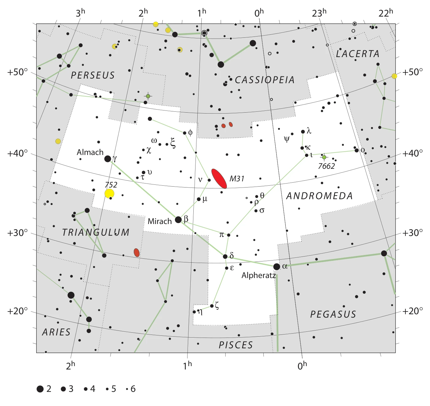
Right ascension, usually written RA, is measured in hours, minutes and seconds around the celestial sphere. A full turn is 24 hours, equivalent to 360 degrees. Multiply decimal hours by 15 to express right ascension in degrees.
Declination, or Dec, measures angular position north or south of the celestial equator. Positive values are north; negative values are south. The two celestial poles have declinations of +90 and −90 degrees.
Right ascension wraps at 24h / 0h. Andromeda is a useful example: a small numerical right ascension on one side of the wrap is close to a large value on the other side. A map projection can make this relationship easy to misread.
What J2000 means
J2000 identifies the reference used for the chart’s coordinates. The orientation of Earth’s axis changes slowly, so equatorial coordinates need a specified reference. J2000 is associated with the standard reference epoch at the beginning of 2000.
The boundary files use J2000 coordinates as documented with the files. They do not contain an observation time, a local horizon or a calculation for the current date.
Stars, patterns and deep-sky objects
Larger dots represent brighter stars. Stars appear dark on light charts and light on dark charts. The magnitude key on each chart explains the scale. Green lines show a constellation pattern, while a separate outline marks the constellation’s boundary.
Clusters, nebulae and galaxies use distinct symbols. Check the graphical legend beside a chart rather than assuming a coloured symbol is a star. A label identifies an object; its symbol is a map marker rather than a photograph.
Zooming and printing
Use the chart controls to enlarge the image, then scroll to move around it. Reset restores the complete chart. Enlarging an image helps you inspect its labels but does not add new astronomical detail.
For paper, download the A4 PDF. Keep the coordinate labels and magnitude key, and consult the legend on the page. A GIF chart and ordered boundary TXT are also available from each constellation page.